FIRST ALERT FORECAST: A nice Saturday ahead before Sunday’s front brings the next chance for rain
LAKE CHARLES, La. (KPLC) - One more very nice day is ahead Saturday, before we start to track the next cold front.
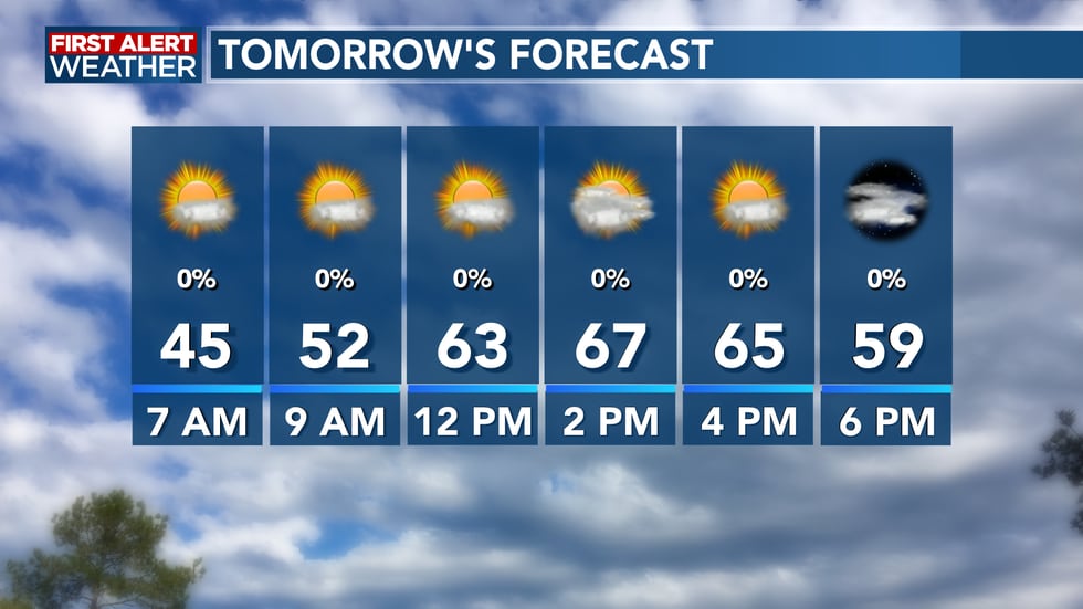
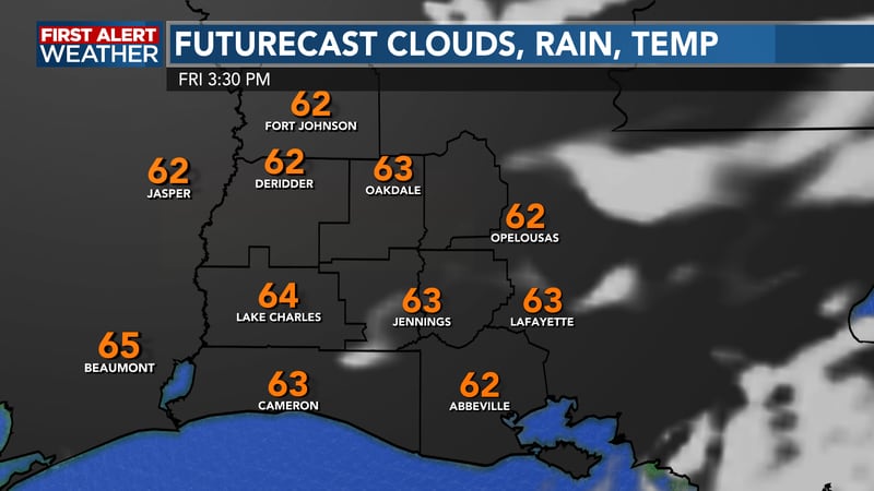
More sunshine and a few upper-level clouds are expected to return during the day, which will allow temperatures to return into the mid 60′s for highs. Humidity levels will remain low and that will make for another comfortable day to spend time outdoors. But the warmer conditions will not last much longer.
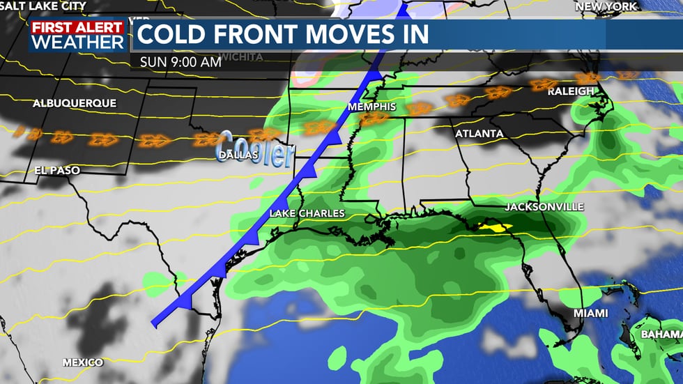
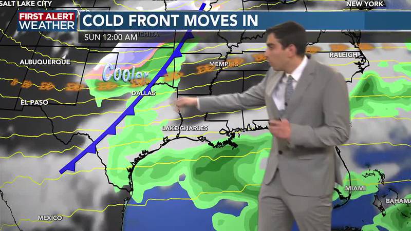
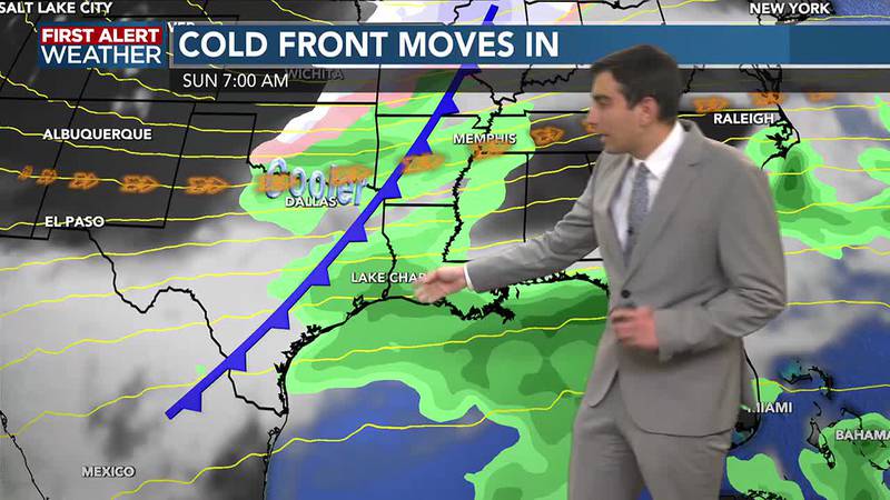
We’re still expecting the next cold front to move through on Sunday. The exact timing on the front is proving hard to pin down with several disturbances expected to move across the area. However, rain is still looking more likely late overnight Saturday into Sunday morning, though there does not appear to be a severe weather risk with this front aside from a stray thunderstorm. If the timing of the front holds, much of any shower or rain activity may actually leave by the afternoon, which would result in a nicer day overall.
This is still plenty of room for this to change. Rainfall amounts currently do not look that impressive, perhaps up to half an inch. However, we could see rain coverage and amounts increase significantly should we see more moisture along the front, which we will be watching closely for those of you travelling back from the Holiday.
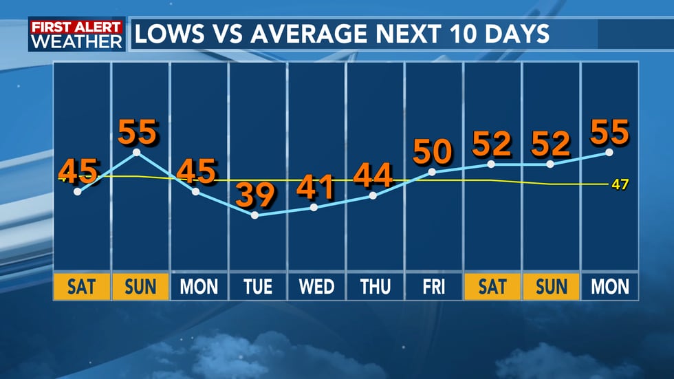
Regardless of timing, the front will bring another round of cold air. Much of next week will likely be cool with highs in the 50s under mostly cloudy skies and lows in the 40s, with some mid/upper 30′s possible in our northern parishes on Tuesday morning. That could allow for some areas of frost to develop if winds relax enough or skies clear, and we’ll watch this too as we head into next week.
For a look at current conditions, our hour-by-hour forecast, radar, and other forecasting tools, visit the KPLC weather page: https://www.kplctv.com/weather/
Copyright 2023 KPLC. All rights reserved.